Forest inventory with multiple sources
Due to its methodology, a statistical forest inventory performs specific measurements over only a small fraction of the sampling area. The sampling grid, the method placing and the density of sampling points coupled with high accuracy and detailed measurements taken at sampling plots serve to counterbalance that problem. In order to ensure that studied parameters are available at the highest accuracy and the greatest level of representativeness possible, the density of the sampling grid should be increased. That, however, is subject to constraints such as finances and human resources, which is why the designers of sampling are responsible for ensuring proper balance.
With remote sensing becoming commonly available, a new opportunity opened up for solving the problem outlined above. That is so because of the constant increase of the amount of information one can retrieve from photographs of large areas and terrestrial surface models. Whilst former aerial and space photographs were only suitable for evaluating forest cover, nowadays tree specimen dimensions can be retrieved as well and it is also quite easy to access a vegetation index that reflects the health status of a whole forest stock.
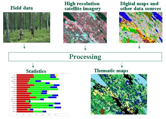
It followed from the above that high precision and high reliability data measured on the ground should be merged with data provided by remote sensing. Potential uncertainties can be compensated by a process of calibration, which involves comparing presumed outcomes received from remote sensing with matching terrestrial data to increase accuracy. The result is a reliable scheme, which can be applied to subsequent information obtained exclusively by remote sensing, which improves the reliability of data considerably.
This method has been applied in several countries even in forest resource assessment. Finland, for instance, has been using it since the late 1980s. Although Hungary claims serious research results and successes in this area, this country does not yet utilise the advantages offered by forest inventories relying on multiple sources, but is planning to apply this method in the near future.

Source: www.metla.fi
Process flow diagram of multiple source forest inventory in the Finnish NFI